
On Wednesday, a large storm could bring heavy snow, strong winds, and bitterly cold temperatures to a large part of the US. This could last until the end of a busy travel week.
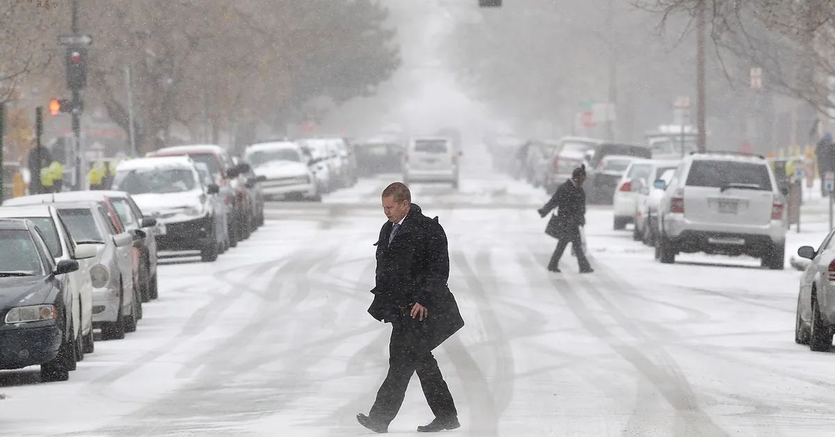
The National Weather Service says that forecasters have warned that a strong storm this week could stop all travel as it moves from the Northwest to the Plains, the Great Lakes, and the central Appalachians, and then to the Northeast by the end of the week. More than 70 million people from Washington state to Maryland are on winter weather alerts.
The weather service said more than a foot of snow would likely fall in the Cascades and parts of northern Idaho, northwest Montana, and western Wyoming. Even if less snow falls in other northern areas, it is expected to be light and fluffy, and winds of 30 to 50 mph could blow it around for the next two to three days, making travel dangerous.
Wind chill alerts have been sent from the Gulf of Mexico to the US-Canada border and from the Pacific Northwest to the Southeast. This is because of the wind and the shallow temperatures. The weather service says that the wind chill, which shows how the wind feels, could be as low as 50 to 70 degrees Fahrenheit below zero.
“Wind chills of this strength can cause frostbite in less than 5 minutes if precautions aren’t taken,” the weather service warned Tuesday. “Long-term exposure to the cold can also cause hypothermia.” By Wednesday morning, the storm will have passed through Montana, Idaho, and Oregon. It will start to affect cities like Minneapolis, Omaha, Denver, and Salt Lake City in the early afternoon and last all night.
United, American, Delta, Southwest, and Jet Blue have all issued travel waivers for dozens of airports across the country, from the South to the Northeast because low visibility and snow on the roads could make air travel dangerous. “With such a big and powerful storm system hitting most of the country during one of the busiest travel weeks of the year, travelers must check the latest forecast before heading out,” the weather service said.
The governors of several states across the country have taken some steps to get ready for the massive storm. A news release says that Colorado Gov. Jared Polis called up more than 100 members of the National Guard to help with operations across the state during freezing weather.
“Colorado is about to face extreme weather and cold temperatures, and the Guard is ready to help local communities keep people safe during this icy weather snap,” Polis said. The governor’s office said in a statement that North Carolina declared a state of emergency on Tuesday to help move fuel and other essential supplies, help first responders, and keep prices from going up too much.
The governor says that West Virginia is now in the State of Preparedness. Missouri has also activated the state’s emergency operations plan, which frees up resources from the National Guard to help with the storm’s effects if needed. A “bomb cyclone” on the rise
So far, snow has fallen chiefly in northern and central Montana, northern and central Idaho, eastern Oregon, the western parts of North Dakota and South Dakota, and the western parts of North Dakota and Colorado. The storm, which is expected to become a bomb cyclone, will get stronger quickly as temperatures drop drastically low across most of the US by the end of the week.
For a storm to be called a “bomb cyclone,” the pressure in the air must drop by 24 millibars in 24 hours. Most of the time, these storms happen during nor’easters in the winter. But this week, the bomb cyclone is expected to hit the Plains, where there is a vast difference in temperature between the warm, moist air in front of the storm and the cold air from Canada behind it.
When it gets to the Great Lakes, the storm is expected to have the same pressure as a Category 2 hurricane. The weather service has called the storm’s strength a “once-in-a-generation” event. “In this case, the amount of snow might not tell the whole story. Even small amounts of snow can make it hard to see and cause slippery spots on the roads when combined with strong winds and falling temperatures. “These conditions can be more dangerous if they come on quickly,” the weather service said.
Also, strong winds could knock out power lines from the Midwest to the Northeast, especially in places where it snowed a lot last week, and tree branches are already heavy from the snow.
I hope you like our article. If this is the case, we would greatly appreciate it if you could share your insightful ideas in the comments area. You can get more of these updates by including the website Journalistpr.com. in your bookmark.
Leave a Reply